


Please Leave Us A Message
Privacy statement: Your privacy is very important to Us. Our company promises not to disclose your personal information to any external company with out your explicit permission.
Yetnorson
 December 07, 2023
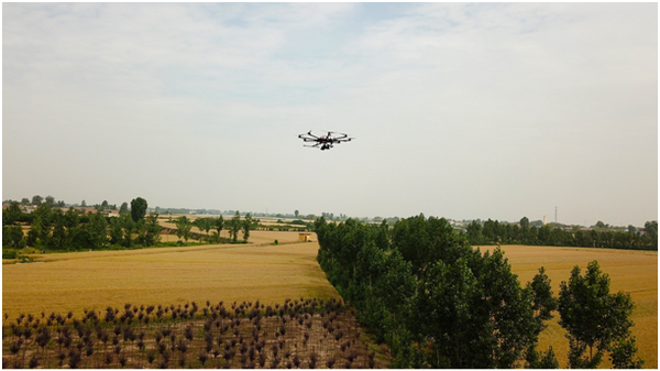
In late May, Xi’an Yiketai UAV Remote Sensing Technology Research Center used the EcoDrone® UAV remote sensing platform to mount RGB color lenses, multi-spectral lenses, and infrared thermal imaging lenses to conduct field crops and roadside trees. Analysis of remote sensing operations.
Through RGB image intensive point cloud extraction and 3D reconstruction, you can measure and analyze plant height, canopy size, crop leaf size inclination, empty seedling rate, seedling spacing, tree spacing, etc., and you can also calculate fill and excavation calculations on 3D point cloud map , Directly derived parameters such as perimeter, plane area, surface area, volume and so on.
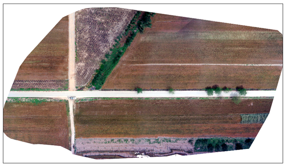
RGB image, the upper right triangle is the newly planted seedlings (some are not alive), the other parts are roads and roadside trees, and large fields of wheat on both sides of the road are about to mature
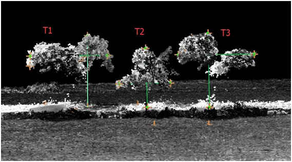
3D dense point clouds of roadside trees, from which the height and crown diameter of T1, T2, T3 are: (10.87m, 9.48m), (6.73m, 7.25m), (9.9m, 9.43m)
The three-dimensional measurement of a sand pit (ROI) in the area is as follows (unit m):
perimeter
Plane area
Surface area
Fill
Digging
volume
ROI
422.735
1748.95
13210.7
-1123.04
261.16
-861.881
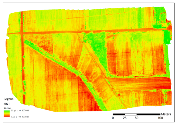
Through multi-spectral remote sensing imaging, you can measure vegetation indices such as plant NDVI, and then analyze and measure crop health and maturity. The red part of the wheat field in the NDVI diagram below indicates that it is approaching the ripe harvest season.
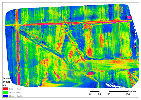
Through infrared thermal imaging, you can analyze the plant's drought stress index, crop maturity, unsuccessful tree planting, soil moisture status, etc.
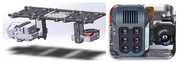
The EcoDrone® UAV remote sensing platform is equipped with high-end sensors such as RGB high-definition lenses, multi-spectral (5-band or 6-band), hyperspectral, and infrared thermal imaging. Chlorophyll fluorometer and other equipment form a comprehensive multi-function monitoring network. The imaging platform module independently developed and designed by the company can be quickly installed on DJI and other third-party drones or ground vehicles for plant phenotype analysis and agricultural condition monitoring.
Feel free to call or email E-Tech Eco Technology (Headquarters) or Xian E-Tech Thai UAV Remote Sensing Technology Research Center
The above is the EcoDrone? UAV field remote sensing measurement we have listed for you. You can submit the following form to obtain more industry information we provide for you.
You can visit our website or contact us, and we will provide the latest consultation and solutions
Send Inquiry
Most Popular
lastest New
Send Inquiry
Privacy statement: Your privacy is very important to Us. Our company promises not to disclose your personal information to any external company with out your explicit permission.
Fill in more information so that we can get in touch with you faster
Privacy statement: Your privacy is very important to Us. Our company promises not to disclose your personal information to any external company with out your explicit permission.